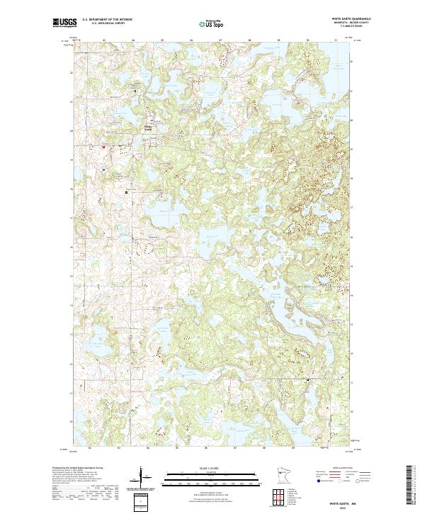
2022 Map of White Earth
USGS Topo · Published 2022About this map
White Earth serves as the primary hub of this landscape, where the cultural and historical presence of the community is anchored by the Saint Columba's Episcopal Mission Cem. The terrain is defined by an intricate network of glacial lakes and wetlands, including the expansive White Earth Lake and Mission Lake. To the south and east, the geography becomes increasingly varied with the elevation of Sugar Hill overlooking Big Sugar Bush Lake and Big Tamarack Lake. Local transport is facilitated by roads such as Resvn Hwy 1 and Co Rd 34, which connect the scattered homesteads and water bodies. This area illustrates a traditional lake-oriented settlement pattern in Becker County, with cemeteries like Calvary Cem and Aura Cem providing key points of reference for genealogical research and local history within the reservation lands.
Find a feature on this map
81 named features on this map. Tap any name to fly to it.
Don’t see what you’re looking for? This feature index may not catch every label — zoom into the map to look around manually.
Map Details
Editions of this 2022 White Earth Map
This is the sole edition of this map. No revisions or reprints were ever made.
Other maps of this area

1953 · Brainerd
USGS Topo · 1:250,000

1954 · Bemidji
USGS Topo · 1:250,000

1957 · Brainerd
USGS Topo · 1:250,000

1957 · Bemidji
USGS Topo · 1:250,000

1958 · Bemidji
USGS Topo · 1:250,000

1958 · Brainerd
USGS Topo · 1:250,000

1959 · Flat Lake
USGS Topo · 1:24,000

1959 · Richwood
USGS Topo · 1:24,000
1959 · Callaway
USGS Topo · 1:24,000

1965 · Brainerd
USGS Topo · 1:250,000