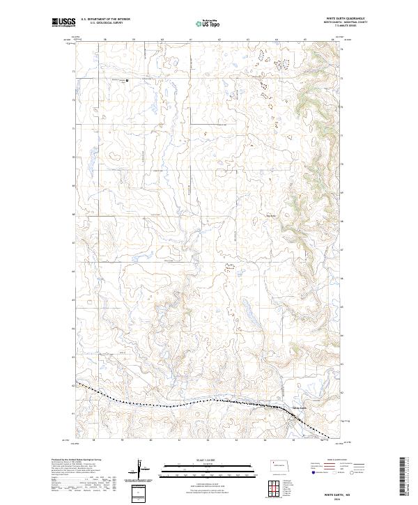
2024 Map of White Earth
USGS Topo · Published 2024About this map
White Earth occupies the low-lying terrain at the junction where Paulsen Creek meets the White Earth River. This modern survey of Mountrail County captures the intersection of natural watercourses and the rigid township and range system, marked by an orderly grid of rural routes such as 100th Ave NW and 74th St NW. To the north, the Norman Lutheran Cem serves as a significant genealogical landmark for the surrounding community. The landscape is defined by its gradual elevation changes, most notably at Big Butte, which stands as a prominent topographical feature overlooking the river valley. The town's small footprint is detailed down to local thoroughfares like Lookout St, providing a clear view of the settlement's relationship with the North Dakota prairie.
Find a feature on this map
23 named features on this map. Tap any name to fly to it.
Don’t see what you’re looking for? This feature index may not catch every label — zoom into the map to look around manually.
Map Details
Editions of this 2024 White Earth Map
This is the sole edition of this map. No revisions or reprints were ever made.
Other maps of this area

1953 · Williston
USGS Topo · 1:250,000

1957 · Williston
USGS Topo · 1:250,000

1969 · Ross NW
USGS Topo · 1:24,000

1969 · White Earth
USGS Topo · 1:24,000

1974 · McGregor
USGS Topo · 1:24,000

1977 · Powers Lake
USGS Topo · 1:24,000

1978 · Battleview
USGS Topo · 1:24,000

1979 · Tioga SE
USGS Topo · 1:24,000
1979 · Tioga SW
USGS Topo · 1:24,000
1979 · Tioga
USGS Topo · 1:24,000