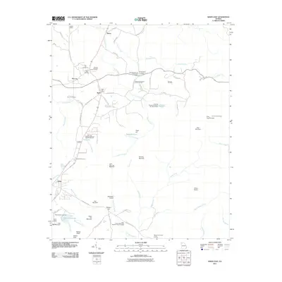
2011 Map of White East
USGS Topo · Published 2011About this map
Pine Log Mountain and Bear Mountain dominate this landscape, which is marked by a legacy of mountain settlements and rural institutions. The map documents a dense network of country burial grounds and sanctuaries, including the Fairview Methodist Church Cemetery and the Miller Chapel Independent Methodist Church Cemetery, reflecting the deep-rooted family ties of Bartow County. Notable landmarks like the Cartersville Poor Farm south of Rydal suggest the social history of the area, while the Pine Log Lookout Tower stands as a sentinel over the terrain. Waterways such as Pine Log Creek and Sugar Hill Creek wind through valleys like Calico Valley, where the community of Bolivar and several post offices served as local hubs. This record is particularly valuable for genealogists tracing the numerous family and church-affiliated cemeteries dispersed across the ridges and hollows.
Find a feature on this map
89 named features on this map. Tap any name to fly to it.
Don’t see what you’re looking for? This feature index may not catch every label — zoom into the map to look around manually.
Map Details
Editions of this 2011 White East Map
This is the sole edition of this map. No revisions or reprints were ever made.
Other maps of this area

1890 · Cartersville
USGS Topo · 1:125,000

1891 · Cartersville
USGS Topo · 1:125,000

1896 · Cartersville
USGS Topo · 1:125,000

1906 · Stilesboro
USGS Topo · 1:62,500

1907 · Acworth
USGS Topo · 1:62,500

1908 · Stilesboro
USGS Topo · 1:62,500

1909 · Acworth
USGS Topo · 1:62,500

1941 · Adairsville
USGS Topo · 1:62,500

1944 · Adairsville
USGS Topo · 1:62,500

1947 · Waleska
USGS Topo · 1:62,500