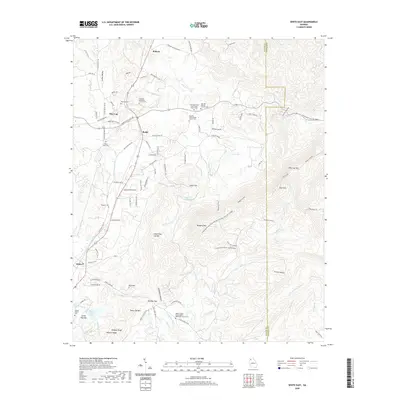
2020 Map of White East
USGS Topo · Published 2020About this map
Pine Log and Rydal anchor this portion of the Georgia Piedmont, where the terrain transitions into the prominent ridges of Pine Log Mtn and Bear Mtn. The landscape is defined by its deep spiritual and genealogical roots, evidenced by numerous historic burial grounds such as Fairview Methodist Church Cem and the Aubrey Family Cem. The settlement pattern follows the local creek valleys, with Bolivar situated near the northern reaches of Pine Log Cr and Sugar Hill positioned toward the center of the sheet.
Find a feature on this map
117 named features on this map. Tap any name to fly to it.
Don’t see what you’re looking for? This feature index may not catch every label — zoom into the map to look around manually.
Map Details
Editions of this 2020 White East Map
This is the sole edition of this map. No revisions or reprints were ever made.
Other maps of this area

1890 · Cartersville
USGS Topo · 1:125,000

1891 · Cartersville
USGS Topo · 1:125,000

1896 · Cartersville
USGS Topo · 1:125,000

1906 · Stilesboro
USGS Topo · 1:62,500

1907 · Acworth
USGS Topo · 1:62,500

1908 · Stilesboro
USGS Topo · 1:62,500

1909 · Acworth
USGS Topo · 1:62,500

1941 · Adairsville
USGS Topo · 1:62,500

1944 · Adairsville
USGS Topo · 1:62,500

1947 · Waleska
USGS Topo · 1:62,500