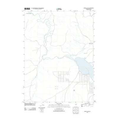
2012 Map of White Flats
USGS Topo · Published 2012About this map
South Fork Reservoir anchors this high-desert landscape in Elko County, serving as a primary focal point for the surrounding residential and recreational developments. The waters of the South Fork Humboldt River feed into this basin after winding through the South Fork Canyon to the northwest. To the south of the reservoir, the community of White Flats is laid out in a distinct grid, with streets named for historical figures and local landmarks, including Sherman Ave, Eisenhower Ave, and Bradley Ave.
Find a feature on this map
37 named features on this map. Tap any name to fly to it.
Don’t see what you’re looking for? This feature index may not catch every label — zoom into the map to look around manually.
Map Details
Editions of this 2012 White Flats Map
This is the sole edition of this map. No revisions or reprints were ever made.
Other maps of this area

1952 · Dixie Flats
USGS Topo · 1:62,500

1955 · Elko
USGS Topo · 1:250,000

1957 · Elko West
USGS Topo · 1:24,000

1957 · Elko East
USGS Topo · 1:24,000

1958 · Elko
USGS Topo · 1:250,000

1958 · Hunter
USGS Topo · 1:24,000

1962 · Elko
USGS Topo · 1:250,000
1962 · Hunter
USGS Topo · 1:24,000
1962 · Elko East
USGS Topo · 1:24,000
1962 · Elko West
USGS Topo · 1:24,000