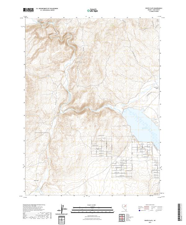
2021 Map of White Flats
USGS Topo · Published 2021About this map
The South Fork Humboldt River carves a deep path through the South Fork Canon before feeding into the South Fork Reservoir, a central water feature in this part of Elko County. The residential layout of White Flats is clearly visible, showing a grid of streets such as Lee Ave, Grant Ave, and Pershing Ave that define the local community. To the north, the terrain rises into the Elko Hills, while the south is characterized by the expansive Dixie Flats and the Dixie Hills. Historical transit routes like the Hamilton Stage Rd and Bullion Rd trace the movement of people and goods across this landscape. Smaller drainages including Tenmile Cr and Dixie Creek weave through the basins, illustrating the hydrological network supporting the South Fork Valley.
Find a feature on this map
60 named features on this map. Tap any name to fly to it.
Don’t see what you’re looking for? This feature index may not catch every label — zoom into the map to look around manually.
Map Details
Editions of this 2021 White Flats Map
This is the sole edition of this map. No revisions or reprints were ever made.
Other maps of this area

1952 · Dixie Flats
USGS Topo · 1:62,500

1955 · Elko
USGS Topo · 1:250,000

1957 · Elko West
USGS Topo · 1:24,000

1957 · Elko East
USGS Topo · 1:24,000

1958 · Elko
USGS Topo · 1:250,000

1958 · Hunter
USGS Topo · 1:24,000

1962 · Elko
USGS Topo · 1:250,000
1962 · Hunter
USGS Topo · 1:24,000
1962 · Elko East
USGS Topo · 1:24,000
1962 · Elko West
USGS Topo · 1:24,000