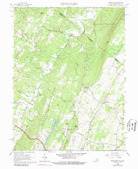
1965 Map of White Hall
USGS Topo · Published 1989About this map
Apple Pie Ridge and North Mountain dominate this landscape along the border of Frederick County and Berkeley County. Surveyed in the mid-1960s, the map illustrates a rural Virginia-West Virginia borderland defined by narrow valleys and persistent ridge-top settlements like White Hall and Cedar Grove. The concentration of religious sites, such as the Old Stone Ch and Pine Grove Ch, points to established community centers that historically linked the scattered farms of the Shenandoah Valley periphery. The presence of Braddock Road highlights the area's deep colonial-era transit roots, while local water bodies like Silver Lake and Lake St Clair provide focal points for recreation and livestock near the southern end of the sheet. Distinctive gaps and hollows, such as Dutton Gap and Warm Springs Hollow, trace the natural pathways through the limestone and sandstone terrain that shaped early regional development.
Find a feature on this map
50 named features on this map. Tap any name to fly to it.
Don’t see what you’re looking for? This feature index may not catch every label — zoom into the map to look around manually.
Map Details
Editions of this 1965 White Hall Map
2 editions found
Other maps of this area

1894 · Winchester
USGS Topo · 1:125,000

1914 · Gerrardstown
USGS Topo · 1:48,000

1916 · Gerrardstown
USGS Topo · 1:62,500

1916 · Capon Bridge
USGS Topo · 1:62,500

1923 · Middletown
USGS Topo · 1:62,500

1923 · Capon Bridge
USGS Topo · 1:62,500

1937 · Capon Bridge
USGS Topo · 1:48,000

1937 · Gerrardstown
USGS Topo · 1:48,000

1937 · Middletown
USGS Topo · 1:48,000

1938 · Winchester
USGS Topo · 1:48,000