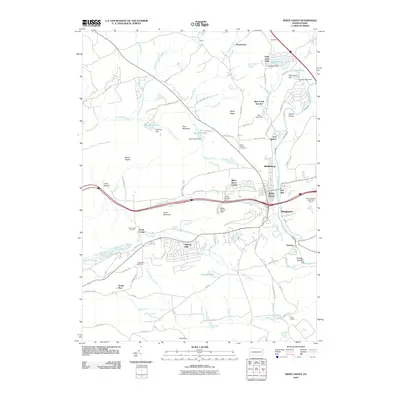
2010 Map of White Haven
USGS Topo · Published 2010About this map
The Lehigh River carves through this Luzerne County landscape, anchoring the borough of White Haven and its surrounding communities. By the early 21st century, the area shows a distinct blend of residential enclaves like Hickory Hills and recreational spaces such as the Pocono Hershey Resort Golf Course. The map details the water management infrastructure of the region, from the White Haven Dam and Penn Lake Dam to the complex of smaller structures like the Santer Springs Dam and Ray T Mantz Dam.
Find a feature on this map
92 named features on this map. Tap any name to fly to it.
Don’t see what you’re looking for? This feature index may not catch every label — zoom into the map to look around manually.
Map Details
Editions of this 2010 White Haven Map
This is the sole edition of this map. No revisions or reprints were ever made.
Other maps of this area

1889 · Hazleton
USGS Topo · 1:62,500

1891 · Wilkesbarre
USGS Topo · 1:62,500

1891 · Hazleton
USGS Topo · 1:62,500

1893 · Hazleton
USGS Topo · 1:62,500

1894 · Wilkesbarre
USGS Topo · 1:62,500

1922 · Mauch Chunk
USGS Topo · 1:62,500

1922 · Stoddartsville
USGS Topo · 1:62,500

1924 · Stoddartsville
USGS Topo · 1:62,500

1924 · Mauch Chunk
USGS Topo · 1:62,500

1943 · Scranton
USGS Topo · 1:125,000