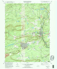
1994 Map of White Haven
USGS Topo · Published 1995About this map
The Lehigh River carves a deep path through the Pocono plateau in this 1994 snapshot of northeastern Pennsylvania. The borough of White Haven sits at the center of a complex network of transportation and conservation lands, where the Pennsylvania Turnpike Northeast Extension and various old railroad grades navigate the steep gaps between Nescopeck Mountain and Buck Mountain. The landscape reveals the region's industrial transitions, showing a prominent strip mine and quarry alongside the established vacation community of Penn Lake Park.
Find a feature on this map
67 named features on this map. Tap any name to fly to it.
Don’t see what you’re looking for? This feature index may not catch every label — zoom into the map to look around manually.
Map Details
Editions of this 1994 White Haven Map
This is the sole edition of this map. No revisions or reprints were ever made.
Other maps of this area

1889 · Hazleton
USGS Topo · 1:62,500

1891 · Wilkesbarre
USGS Topo · 1:62,500

1891 · Hazleton
USGS Topo · 1:62,500

1893 · Hazleton
USGS Topo · 1:62,500

1894 · Wilkesbarre
USGS Topo · 1:62,500

1922 · Mauch Chunk
USGS Topo · 1:62,500

1922 · Stoddartsville
USGS Topo · 1:62,500

1924 · Stoddartsville
USGS Topo · 1:62,500

1924 · Mauch Chunk
USGS Topo · 1:62,500

1943 · Scranton
USGS Topo · 1:125,000