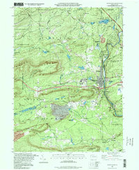
1997 Map of White Haven
USGS Topo · Published 1998About this map
The Lehigh Valley Railroad and Conrail lines define the industrial corridor of this landscape, following the deep cut of the Lehigh River through the heart of the Pocono region. The borough of White Haven serves as the central hub, surrounded by smaller settlements like Middleburg, East Side, and the resort community of Penn Lake Park. This survey reveals a landscape balanced between heavy transit and conservation, where the Northeast Extension Pennsylvania Turnpike bisects vast protected areas, including State Game Lands No 187 and Lehigh Gorge State Park.
Find a feature on this map
57 named features on this map. Tap any name to fly to it.
Don’t see what you’re looking for? This feature index may not catch every label — zoom into the map to look around manually.
Map Details
Editions of this 1997 White Haven Map
This is the sole edition of this map. No revisions or reprints were ever made.
Other maps of this area

1889 · Hazleton
USGS Topo · 1:62,500

1891 · Wilkesbarre
USGS Topo · 1:62,500

1891 · Hazleton
USGS Topo · 1:62,500

1893 · Hazleton
USGS Topo · 1:62,500

1894 · Wilkesbarre
USGS Topo · 1:62,500

1922 · Mauch Chunk
USGS Topo · 1:62,500

1922 · Stoddartsville
USGS Topo · 1:62,500

1924 · Stoddartsville
USGS Topo · 1:62,500

1924 · Mauch Chunk
USGS Topo · 1:62,500

1943 · Scranton
USGS Topo · 1:125,000