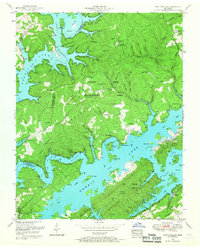
1952 Map of White Hollow
USGS Topo · Published 1967About this map
Norris Lake dominates this 1952 topographic study, its fingers reaching deep into the ridges and hollows of Union County following the creation of the reservoir. The map reveals the intricate shoreline where the Powell River and Clinch River meet, highlighting a landscape defined by sharp elevation changes and numerous family-named landmarks. The Chuck Swan Management Area covers a significant portion of the central peninsula, preserving a network of older sites such as Mt Olive Cemetery and Bridges-Miller Cemetery.
Find a feature on this map
66 named features on this map. Tap any name to fly to it.
Don’t see what you’re looking for? This feature index may not catch every label — zoom into the map to look around manually.
Map Details
Editions of this 1952 White Hollow Map
4 editions found
Other maps of this area

1893 · Briceville
USGS Topo · 1:125,000

1895 · Briceville
USGS Topo · 1:125,000

1896 · Briceville
USGS Topo · 1:125,000

1897 · Maynardville
USGS Topo · 1:125,000

1900 · Maynardville
USGS Topo · 1:125,000

1935 · Graveston
USGS Topo · 1:24,000

1935 · Well Spring
USGS Topo · 1:24,000

1936 · Gorryton
USGS Topo · 1:48,000

1936 · Ausmus
USGS Topo · 1:24,000

1936 · White Hollow
USGS Topo · 1:24,000