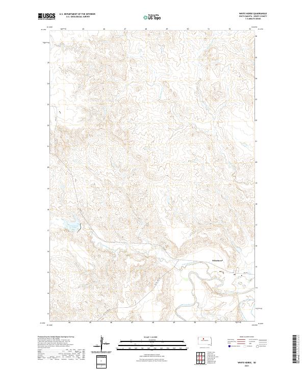
2021 Map of White Horse
USGS Topo · Published 2021About this map
Whitehorse sits at the eastern edge of this Dewey County landscape, where the Moreau River and Little Moreau River converge. The topography is defined by the drainage basins of Whitehorse Cr and Dog Butte Cr, which carve through the high plains terrain. This 2021 survey illustrates the rural infrastructure of the Cheyenne River Reservation, anchored by localized water features such as Whitehorse Lake. Transport in the area relies on a network of tribal and county routes, including Bia Hwy 4 and the descriptively named On The Tree Rd. The map also preserves the administrative grid of the Public Land Survey System, marking the boundaries of t16n r26e and surrounding townships, providing a clear record of land division and natural watercourses in this portion of South Dakota.
Find a feature on this map
13 named features on this map. Tap any name to fly to it.
Don’t see what you’re looking for? This feature index may not catch every label — zoom into the map to look around manually.
Map Details
Editions of this 2021 White Horse Map
This is the sole edition of this map. No revisions or reprints were ever made.
Other maps of this area

1951 · Ridgeview NW
USGS Topo · 1:24,000

1951 · Ridgeview NE
USGS Topo · 1:24,000

1952 · Whitehorse
USGS Topo · 1:24,000

1952 · Parade NE
USGS Topo · 1:24,000

1952 · Glencross SE
USGS Topo · 1:24,000

1953 · McIntosh
USGS Topo · 1:250,000

1958 · McIntosh
USGS Topo · 1:250,000

1975 · Glencross
USGS Topo · 1:24,000
1975 · Glencross NE
USGS Topo · 1:24,000

1978 · Timber Lake
USGS Topo · 1:24,000