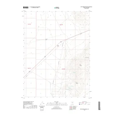
2018 Map of White Horse Mountain
USGS Topo · Published 2018About this map
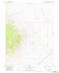
Goshute Mountains rise sharply above the high desert floor in this eastern Nevada landscape, dominated by the prominent summit of White Horse Mtn. The terrain is defined by a stark contrast between the steep, rugged slopes of the range and the broad, level expanse of Dolly Varden Flat and Antelope Valley to the west. Evidence of the region's scarce but vital water sources is found in a series of numbered catchments, including Battle Spring Number One, Battle Spring Number Two, and Battle Spring Number Three, clustered near the eastern slopes. Transportation in this arid environment follows established corridors like Alt 93 and the historic alignment of Old Hwy 93, while the Kinsley Mtn Mine Rd suggests the enduring importance of local extraction industries.
Find a feature on this map
17 named features on this map. Tap any name to fly to it.
Don’t see what you’re looking for? This feature index may not catch every label — zoom into the map to look around manually.
Map Details
Editions of this 2018 White Horse Mountain Map
This is the sole edition of this map. No revisions or reprints were ever made.
Other maps of this area

1955 · Elko
USGS Topo · 1:250,000

1958 · Elko
USGS Topo · 1:250,000

1962 · Elko
USGS Topo · 1:250,000

1965 · Elko
USGS Topo · 1:250,000

1972 · White Horse Pass
USGS Topo · 1:24,000

1972 · Ferguson Mtn.
USGS Topo · 1:24,000
1982 · Kinsley Mountains
USGS Topo · 1:24,000
1982 · Goshute Peak
USGS Topo · 1:24,000
1982 · Boone Canyon
USGS Topo · 1:24,000
1982 · Dolly Varden Spring
USGS Topo · 1:24,000