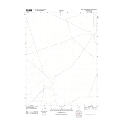
2012 Map of White Horse Mountain NW
USGS Topo · Published 2012About this map
Elko County high desert terrain defines this quadrangle in northeast Nevada, where a sparse network of roads and tracks crisscrosses the open landscape. The primary drainage feature identified on the map is N Cr, which meanders through the southwestern section of the sheet. This area remains largely undeveloped, characterized by wide-open spaces and the intricate topography of the Basin and Range province. The lack of named settlements or structures emphasizes the isolation of this corner of the state, serving as a clean record of the region's vast road network as it existed in the early twenty-first century.
Find a feature on this map
1 named feature on this map. Tap any name to fly to it.
Don’t see what you’re looking for? This feature index may not catch every label — zoom into the map to look around manually.
Map Details
Editions of this 2012 White Horse Mountain NW Map
This is the sole edition of this map. No revisions or reprints were ever made.
Other maps of this area

1953 · Spruce Mountain 4
USGS Topo · 1:62,500

1955 · Elko
USGS Topo · 1:250,000

1958 · Elko
USGS Topo · 1:250,000

1962 · Elko
USGS Topo · 1:250,000

1965 · Elko
USGS Topo · 1:250,000

1972 · Lion Spring
USGS Topo · 1:24,000

1972 · Decoy SW
USGS Topo · 1:24,000
1982 · Goshute Peak
USGS Topo · 1:24,000

1982 · Sharp Peak
USGS Topo · 1:24,000
1982 · Dolly Varden Spring
USGS Topo · 1:24,000