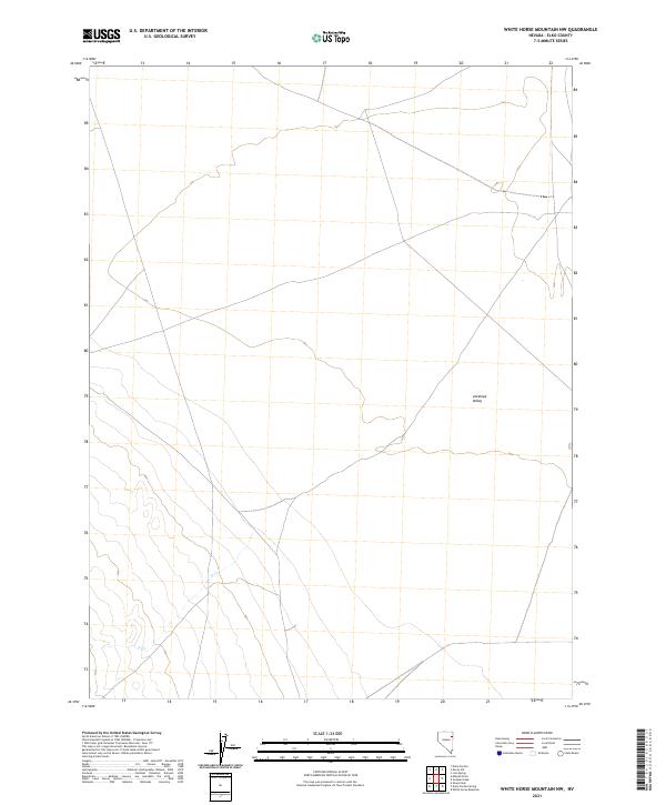
2021 Map of White Horse Mountain NW
USGS Topo · Published 2021About this map
Antelope Valley defines the core of this modern topographic record in eastern Elko County, Nevada. The landscape is characterized by its broad, high-desert basin drainage, notably represented by the subtle course of N Cr as it traverses the southern portions of the sheet. The map provides precise township and range surveying for the transition between t30n r66e, t30n r67e, t29n r66e, and t29n r67e, detailing the vast, unpopulated terrain before any modern industrial or urban expansion. It is a vital tool for understanding the land use and hydrography of the Great Basin at the start of the 2020s, showing a region where the natural topography remains the dominant feature of the human geography.
Find a feature on this map
6 named features on this map. Tap any name to fly to it.
Don’t see what you’re looking for? This feature index may not catch every label — zoom into the map to look around manually.
Map Details
Editions of this 2021 White Horse Mountain NW Map
This is the sole edition of this map. No revisions or reprints were ever made.
Other maps of this area

1953 · Spruce Mountain 4
USGS Topo · 1:62,500

1955 · Elko
USGS Topo · 1:250,000

1958 · Elko
USGS Topo · 1:250,000

1962 · Elko
USGS Topo · 1:250,000

1965 · Elko
USGS Topo · 1:250,000

1972 · Lion Spring
USGS Topo · 1:24,000

1972 · Decoy SW
USGS Topo · 1:24,000
1982 · Goshute Peak
USGS Topo · 1:24,000

1982 · Sharp Peak
USGS Topo · 1:24,000
1982 · Dolly Varden Spring
USGS Topo · 1:24,000