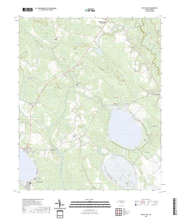
2022 Map of White Lake
USGS Topo · Published 2022About this map
The eponymous oval of White Lake and the nearby Bay Tree Lake dominate this landscape, part of a unique geological cluster of Carolina bays. These shallow, elliptical depressions define the region's hydrology, with extensive wetlands like Colly Swamp and Johns Swamp surrounding the water bodies. The settlement of White Lake serves as a local hub, while the interior is dotted with small agricultural junctions such as Hickory Grove Crossroads and Smith Crossroads.
Find a feature on this map
77 named features on this map. Tap any name to fly to it.
Don’t see what you’re looking for? This feature index may not catch every label — zoom into the map to look around manually.
Map Details
Editions of this 2022 White Lake Map
This is the sole edition of this map. No revisions or reprints were ever made.
Other maps of this area

1953 · Florence
USGS Topo · 1:250,000

1954 · Florence
USGS Topo · 1:250,000

1954 · White Lake
USGS Topo · 1:62,500

1955 · Elizabethtown
USGS Topo · 1:62,500

1959 · Roseboro
USGS Topo · 1:62,500

1959 · Garland
USGS Topo · 1:62,500

1982 · Elizabethtown
USGS Topo · 1:100,000
1986 · Ingold
USGS Topo · 1:24,000
1986 · Garland
USGS Topo · 1:24,000
1986 · Singletary Lake
USGS Topo · 1:24,000