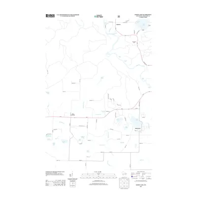
2013 Map of White Lake
USGS Topo · Published 2013About this map
The settlement of White Lake anchor’s this portion of Langlade County, defined by a complex network of glacial lakes and river systems. The Wolf River flows through the northern terrain, marked by a series of named whitewater features including Cedar Rapids, Hemlock Rapids, and Sherry Rapids. To the north, the small community of Hollister sits near the confluence of Ninemile Cr and the river, while Four Corners marks a central intersection further west.
Find a feature on this map
77 named features on this map. Tap any name to fly to it.
Don’t see what you’re looking for? This feature index may not catch every label — zoom into the map to look around manually.
Map Details
Editions of this 2013 White Lake Map
This is the sole edition of this map. No revisions or reprints were ever made.
Other maps of this area

1942 · Wabeno
USGS Topo · 1:48,000

1942 · Pearson
USGS Topo · 1:48,000

1950 · Wabeno
USGS Topo · 1:48,000

1950 · Lily
USGS Topo · 1:48,000

1951 · Wabeno
USGS Topo · 1:48,000

1952 · White Lake
USGS Topo · 1:48,000

1952 · Langlade
USGS Topo · 1:48,000

1954 · Iron Mountain
USGS Topo · 1:250,000

1959 · Iron Mountain
USGS Topo · 1:250,000
1972 · Reservoir Pond
USGS Topo · 1:24,000