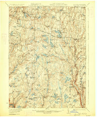
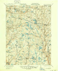
1922 Map of White Lake
USGS Topo · Published 1927About this map
Glacial lakes and small rural settlements dominate this Catskills landscape during the early 1920s. Centered on the resort community of White Lake, the terrain is defined by a high density of water bodies, including Lake Huntington, Lake Superior, and the smaller Little Black Lake. This era shows a network of local district schools like Mount Hope School, Starlight School, and Bushville School serving the scattered hamlets of Bethel, Eldred, and Mongaup Valley. The map records the remnants of early 19th-century industry and transport, such as the Hauck Mill Hunter Pond and the Plank Road running through the heart of the district. Near the southeastern corner, the Dutch Settlement Falls and Fowlersville suggest more concentrated river-based activity along the banks of the Mongaup River.
Find a feature on this map
98 named features on this map. Tap any name to fly to it.
Don’t see what you’re looking for? This feature index may not catch every label — zoom into the map to look around manually.
Map Details
Editions of this 1922 White Lake Map
6 editions found

Other maps of this area

1906 · Port Jervis
USGS Topo · 1:62,500

1908 · Port Jervis
USGS Topo · 1:62,500

1909 · Monticello
USGS Topo · 1:62,500

1910 · Neversink
USGS Topo · 1:62,500

1911 · Monticello
USGS Topo · 1:62,500

1913 · Milford
USGS Topo · 1:62,500

1915 · Milford
USGS Topo · 1:62,500

1920 · Long Eddy
USGS Topo · 1:62,500

1920 · Damascus
USGS Topo · 1:62,500

1921 · Long Eddy
USGS Topo · 1:48,000