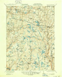
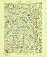
1922 Map of White Lake
USGS Topo · Published 1950About this map
Bethel and the surrounding Catskill foothills appear here in the early 1920s, a landscape defined by an intricate network of highland lakes and small rural school districts. The map documents the distribution of local education through sites like Wellstown School, Bushville School, and West Bethel School, reflecting the era's decentralized community structure before significant school consolidation. A notable industrial feature is the Pipe Line crossing north-to-south through the center of the sheet, cutting a distinct path past Toronto Lake and Whitney Pond.
Find a feature on this map
119 named features on this map. Tap any name to fly to it.
Don’t see what you’re looking for? This feature index may not catch every label — zoom into the map to look around manually.
Map Details
Editions of this 1922 White Lake Map
6 editions found

Other maps of this area

1906 · Port Jervis
USGS Topo · 1:62,500

1908 · Port Jervis
USGS Topo · 1:62,500

1909 · Monticello
USGS Topo · 1:62,500

1910 · Neversink
USGS Topo · 1:62,500

1911 · Monticello
USGS Topo · 1:62,500

1913 · Milford
USGS Topo · 1:62,500

1915 · Milford
USGS Topo · 1:62,500

1920 · Long Eddy
USGS Topo · 1:62,500

1920 · Damascus
USGS Topo · 1:62,500

1921 · Long Eddy
USGS Topo · 1:48,000