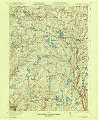
1922 Map of White Lake
USGS Topo · Published 1943About this map
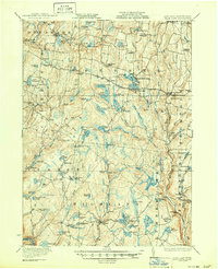
White Lake and the township of Bethel anchor this 1920s landscape, characterized by a dense network of glacial lakes and mountain ponds during the early decades of the Catskill resort era. The map traces significant transportation corridors including the Newburgh and Cochecton Road, the Pike Line, and the Plank Road, which facilitated travel between the hamlets of Fosterdale, Mongaup Valley, and Eldred. A rural social fabric is visible through numerous one-room schoolhouses like Hurd School and Bushville School, alongside family landmarks such as Stewart Cemetery. The concentration of water bodies, from Lake Huntington to Lake Superior, reflects the region's transition from early industrial sites like Falls Mill toward its identity as a premier seasonal destination. Small agrarian hamlets such as Dutch Settlement and Cochecton Center are documented before significant mid-century changes altered the local population centers.
Find a feature on this map
99 named features on this map. Tap any name to fly to it.
Don’t see what you’re looking for? This feature index may not catch every label — zoom into the map to look around manually.
Map Details
Editions of this 1922 White Lake Map
6 editions found

Other maps of this area

1906 · Port Jervis
USGS Topo · 1:62,500

1908 · Port Jervis
USGS Topo · 1:62,500

1909 · Monticello
USGS Topo · 1:62,500

1910 · Neversink
USGS Topo · 1:62,500

1911 · Monticello
USGS Topo · 1:62,500

1913 · Milford
USGS Topo · 1:62,500

1915 · Milford
USGS Topo · 1:62,500

1920 · Long Eddy
USGS Topo · 1:62,500

1920 · Damascus
USGS Topo · 1:62,500

1921 · Long Eddy
USGS Topo · 1:48,000