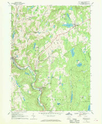
1967 Map of White Mills
USGS Topo · Published 1970About this map
The Lackawaxen River corridor serves as the primary artery of development in this Pennsylvania landscape, where the Erie Lackawanna railroad follows the winding water south toward White Mills. This industrial and transport spine contrasts with the surrounding uplands, which are dotted with small rural communities like Berlin Center and Indian Orchard. The presence of the Honesdale Airport and a Drive-in Theater near the river bend indicates the mid-century suburban expansion of nearby Honesdale.
Find a feature on this map
67 named features on this map. Tap any name to fly to it.
Don’t see what you’re looking for? This feature index may not catch every label — zoom into the map to look around manually.
Map Details
Editions of this 1967 White Mills Map
4 editions found
Other maps of this area

1892 · Honesdale
USGS Topo · 1:62,500

1920 · Damascus
USGS Topo · 1:62,500

1923 · Damascus
USGS Topo · 1:62,500

1928 · Ariel
USGS Topo · 1:62,500

1932 · Ariel
USGS Topo · 1:62,500

1935 · Hawley
USGS Topo · 1:62,500

1938 · Hawley
USGS Topo · 1:62,500

1943 · Honesdale
USGS Topo · 1:125,000

1944 · Damascus
USGS Topo · 1:62,500

1946 · Honesdale
USGS Topo · 1:24,000
Featured Places
- Lackawaxen Township, PA
- Honesdale, PA
- Damascus Township, PA
- Cherry Ridge Township, PA
- Dyberry Township, PA