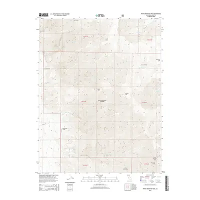
2015 Map of White Mountain Peak
USGS Topo · Published 2015About this map
White Mountain Peak dominates the high-altitude landscape of the White-Inyo Range, marking one of the most prominent summits in the Eastern Sierra region. This 2015 survey by the U.S. Geological Survey details the stark, high-desert alpine environment within the Inyo National Forest. The map reveals a complex network of drainage systems, including Pellisier Cr and Birch Cr flowing from the high ridges down into deep cuts like Middle Canyon and Cottonwood Canyon. At higher elevations, the terrain levels out into unique geographic features such as Chiatovich Flats, while sharp summits like Mt Hogue and Indian Peak provide reference points for hikers and researchers. The southern portion of the sheet shows the descent into Jeffrey Mine Canyon, illustrating the transition from the peaks toward the valley floors of Mono County.
Find a feature on this map
30 named features on this map. Tap any name to fly to it.
Don’t see what you’re looking for? This feature index may not catch every label — zoom into the map to look around manually.
Map Details
Editions of this 2015 White Mountain Peak Map
This is the sole edition of this map. No revisions or reprints were ever made.
Other maps of this area

1917 · White Mountain
USGS Topo · 1:125,000

1947 · Mariposa
USGS Topo · 1:250,000

1948 · Mariposa
USGS Topo · 1:250,000

1957 · Mariposa
USGS Topo · 1:250,000

1962 · Benton
USGS Topo · 1:62,500

1962 · Mt. Barcroft
USGS Topo · 1:62,500

1962 · White Mtn. Peak
USGS Topo · 1:62,500

1963 · Mariposa
USGS Topo · 1:250,000

1963 · Davis Mountain
USGS Topo · 1:62,500
1987 · Juniper Mtn
USGS Topo · 1:24,000