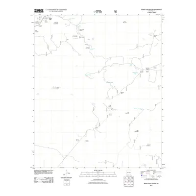
2011 Map of White Oaks South
USGS Topo · Published 2011About this map
White Oaks and its surrounding mining landscape are the focal point of this New Mexico quadrangle, where the White Oaks Historic District preserves the memory of a former boomtown. The hills are dense with evidence of late 19th and early 20th-century extraction, including the Old Abe Mines, the Lincoln Light and Power Company Mine, and smaller operations like the Martin Mine and Emeline Mine. Beyond the shafts, the topography transitions from the high peaks of Carrizo Mountain and Patos Mountain into deep drainage systems like Coal Dump Canyon and Johnnie Canyon. A network of water sources, from the Section Twenty-six Tank to Madden Spring, supported the ranching life that succeeded the mining era, visible in family-named locations such as Goodloe Ranch and Robinson Ranch. Near the townsite, the Cedarvale Cemetery stands as a final record of the early residents of this high-desert community.
Find a feature on this map
62 named features on this map. Tap any name to fly to it.
Don’t see what you’re looking for? This feature index may not catch every label — zoom into the map to look around manually.
Map Details
Editions of this 2011 White Oaks South Map
This is the sole edition of this map. No revisions or reprints were ever made.
Other maps of this area

1934 · Capitan
USGS Topo · 1:48,000

1937 · Capitan
USGS Topo · 1:62,500

1938 · Carrizozo
USGS Topo · 1:48,000

1943 · Carrizozo
USGS Topo · 1:62,500

1950 · Carrizozo
USGS Topo · 1:62,500

1950 · Little Black Peak
USGS Topo · 1:62,500

1955 · Roswell
USGS Topo · 1:250,000

1958 · Roswell
USGS Topo · 1:250,000

1962 · Roswell
USGS Topo · 1:250,000

1973 · Jacob Spring
USGS Topo · 1:24,000