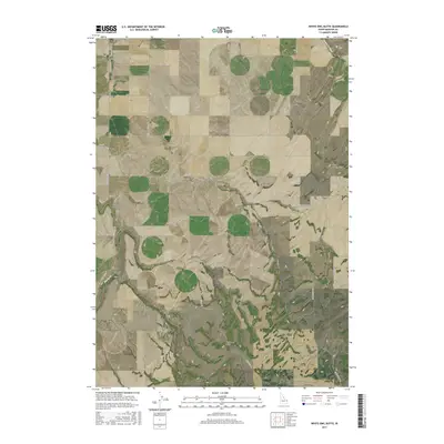
2017 Map of White Owl Butte
USGS Topo · Published 2017About this map
White Owl Butte rises as a prominent landmark in this section of Madison County, characterizing a landscape defined by volcanic geology and agricultural water management. The terrain is marked by distinct topographical features like Bitters Butte and Canyon Creek Butte, which overlook the deep incision of Long Hollow. These high points serve as natural anchors for the surrounding road network, including White Owl Rd and Webster Butte Rd.
Find a feature on this map
25 named features on this map. Tap any name to fly to it.
Don’t see what you’re looking for? This feature index may not catch every label — zoom into the map to look around manually.
Map Details
Editions of this 2017 White Owl Butte Map
This is the sole edition of this map. No revisions or reprints were ever made.
Other maps of this area

1943 · Garns Mtn
USGS Topo · 1:62,500

1946 · Garns Mtn
USGS Topo · 1:62,500

1949 · Newdale
USGS Topo · 1:24,000

1950 · Newdale
USGS Topo · 1:24,000

1950 · St Anthony
USGS Topo · 1:24,000

1951 · Moody
USGS Topo · 1:24,000

1951 · Hawley Gulch
USGS Topo · 1:24,000

1951 · Heise
USGS Topo · 1:24,000

1951 · White Owl Butte
USGS Topo · 1:24,000

1955 · Driggs
USGS Topo · 1:250,000