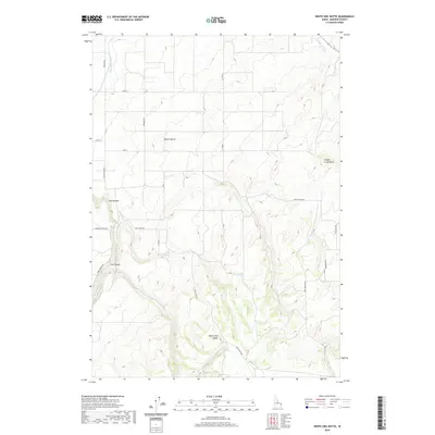
2020 Map of White Owl Butte
USGS Topo · Published 2020About this map
White Owl Butte rises from a landscape defined by significant elevation changes and agricultural engineering in Madison County. The terrain is marked by distinctive geological formations such as Bitters Butte and Canyon Creek Butte, which overlook the natural drainage of Moody Cr and the carved terrain of Long Hollow and Dry Canyon. The surveyor's grid is overlaid with an extensive network of local roads including Webster Butte Rd and White Owl Rd, alongside more idiosyncratic paths like Junkyard Rd. Water management is central to the area's utility, evidenced by the Enterprise Canal and the Canyon Creek Canal. These man-made waterways illustrate the vital intersection of engineering and the high desert environment, supporting the surrounding rural reaches of the Snake River Plain during this 2020 update.
Find a feature on this map
26 named features on this map. Tap any name to fly to it.
Don’t see what you’re looking for? This feature index may not catch every label — zoom into the map to look around manually.
Map Details
Editions of this 2020 White Owl Butte Map
This is the sole edition of this map. No revisions or reprints were ever made.
Other maps of this area

1943 · Garns Mtn
USGS Topo · 1:62,500

1946 · Garns Mtn
USGS Topo · 1:62,500

1949 · Newdale
USGS Topo · 1:24,000

1950 · Newdale
USGS Topo · 1:24,000

1950 · St Anthony
USGS Topo · 1:24,000

1951 · Moody
USGS Topo · 1:24,000

1951 · Hawley Gulch
USGS Topo · 1:24,000

1951 · Heise
USGS Topo · 1:24,000

1951 · White Owl Butte
USGS Topo · 1:24,000

1955 · Driggs
USGS Topo · 1:250,000