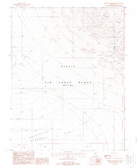
1987 Map of White Patch Draw
USGS Topo · Published 1988About this map
Nellis Air Force Range (Restricted Area) dominates this high-desert landscape in the late 1980s, revealing a terrain used for sensitive military operations and mineral exploration. The southern portion of the Cactus Range transitions into the expansive Flat and the Stonewall Depression, where the map identifies specialized military features such as a Radioactive Area and multiple Targets. Evidence of historic and active mining activity is scattered across the northern slopes, with numerous Prospects, a Mine Shaft, and an Adit located near White Patch Draw. This document captures a specific moment in the management of the Great Basin's public lands, where Cold War-era military restrictions intersected with the region's enduring mining heritage.
Find a feature on this map
14 named features on this map. Tap any name to fly to it.
Don’t see what you’re looking for? This feature index may not catch every label — zoom into the map to look around manually.
Map Details
Editions of this 1987 White Patch Draw Map
This is the sole edition of this map. No revisions or reprints were ever made.
Other maps of this area

1908 · Kawich
USGS Topo · 1:250,000

1908 · Lida
USGS Topo · 1:250,000

1913 · Lida
USGS Topo · 1:250,000

1942 · Cactus Range
USGS Topo · 1:125,000

1945 · Goldfield
USGS Topo · 1:125,000

1952 · Cactus Spring
USGS Topo · 1:62,500

1952 · Mud Lake
USGS Topo · 1:62,500

1952 · Goldfield
USGS Topo · 1:62,500

1952 · Cactus Peak
USGS Topo · 1:62,500

1954 · Goldfield
USGS Topo · 1:250,000