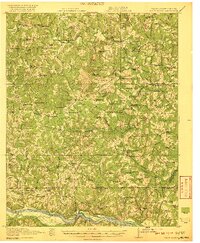
1920 Map of White Plains
USGS Topo · Published 1920About this map
Meherrin River and the Roanoke River define the winding agricultural landscape of this border region between Virginia and North Carolina. Surveyed just after the Great War, the terrain is dotted with small-scale rural infrastructure, from Hicks Mill and Starks Mill to the Old Roanoke Mill downstream from Eatons Ferry. The settlement pattern reveals a highly localized social structure, evidenced by the numerous segregated community hubs such as Zion Union School No 1 and Zion Union School No 2, alongside dozens of country churches like Star Rock Church and St Pauls Chapel. Transportation in this era relied on a network of named crossings including Jones Low Bridge and Pennington Bridge, while the far southeastern corner shows the influence of the rail line at Vultare Sta. The map captures a moment before modern consolidation, where every crossroad like Gholsonville or Valentines maintained its own school and general store.
Find a feature on this map
110 named features on this map. Tap any name to fly to it.
Don’t see what you’re looking for? This feature index may not catch every label — zoom into the map to look around manually.
Map Details
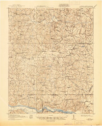
Editions of this 1920 White Plains Map
4 editions found
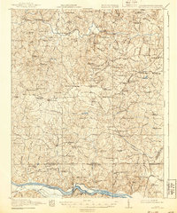
Other maps of this area

1918 · Lawrenceville
USGS Topo · 1:62,500

1919 · Mc Kenney
USGS Topo · 1:48,000

1919 · White Plains
USGS Topo · 1:48,000

1919 · Emporia
USGS Topo · 1:62,500

1920 · Lawrenceville
USGS Topo · 1:48,000

1920 · White Plains
USGS Topo · 1:62,500

1921 · Mc Kenney
USGS Topo · 1:62,500

1921 · Lawrenceville
USGS Topo · 1:62,500

1942 · Lawrenceville
USGS Topo · 1:62,500

1942 · Emporia
USGS Topo · 1:62,500