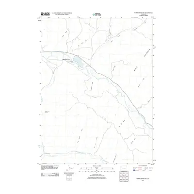
2010 Map of White River City
USGS Topo · Published 2010About this map
White River City and the surrounding high desert terrain are defined by the winding course of the White River, which dominates the northern half of this 2010 survey. The landscape is characterized by a dense network of drainages named for early residents and landmarks, including Ernie Howard Gulch, Tom Stith Gulch, and Little Reigan Gulch, which feed into the Piceance Creek and Dry Fork Piceance Creek systems. A focal point of the area's water management is Rio Blanco Lake, held by the Johnnie Johnson Dam.
Find a feature on this map
29 named features on this map. Tap any name to fly to it.
Don’t see what you’re looking for? This feature index may not catch every label — zoom into the map to look around manually.
Map Details
Editions of this 2010 White River City Map
This is the sole edition of this map. No revisions or reprints were ever made.
Other maps of this area

1907 · White River
USGS Topo · 1:125,000

1910 · White River
USGS Topo · 1:125,000

1952 · Greasewood Gulch
USGS Topo · 1:24,000

1952 · Square S Ranch
USGS Topo · 1:24,000

1952 · Segar Mountain
USGS Topo · 1:24,000

1954 · Vernal
USGS Topo · 1:250,000

1956 · Grand Junction
USGS Topo · 1:250,000

1958 · Vernal
USGS Topo · 1:250,000

1959 · Grand Junction
USGS Topo · 1:250,000

1960 · Vernal
USGS Topo · 1:250,000