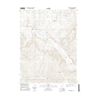
2016 Map of White River City
USGS Topo · Published 2016About this map
White River City sits at the confluence of several high-desert drainages in this 2016 survey, reflecting a landscape defined by water access and industrial history. The map detail highlights a rugged topography carved by the White River and its various tributaries, such as the Dry Fork Piceance Cr. Local naming conventions reveal a history of early ranching and prospecting, with features like Ernie Howard Gulch, Tom Stith Gulch, and Kissinger Gulch providing a genealogical record of former inhabitants. Near the center of the sheet, Rio Blanco Lake serves as a prominent landmark amidst a network of county roads like Co RD 142 and Co RD 84. The presence of Oil Well Gulch and Black Mtn points to the long-standing extraction and mineral potential that has shaped this part of Rio Blanco County for generations.
Find a feature on this map
37 named features on this map. Tap any name to fly to it.
Don’t see what you’re looking for? This feature index may not catch every label — zoom into the map to look around manually.
Map Details
Editions of this 2016 White River City Map
This is the sole edition of this map. No revisions or reprints were ever made.
Other maps of this area

1907 · White River
USGS Topo · 1:125,000

1910 · White River
USGS Topo · 1:125,000

1952 · Greasewood Gulch
USGS Topo · 1:24,000

1952 · Square S Ranch
USGS Topo · 1:24,000

1952 · Segar Mountain
USGS Topo · 1:24,000

1954 · Vernal
USGS Topo · 1:250,000

1956 · Grand Junction
USGS Topo · 1:250,000

1958 · Vernal
USGS Topo · 1:250,000

1959 · Grand Junction
USGS Topo · 1:250,000

1960 · Vernal
USGS Topo · 1:250,000