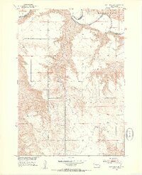
1951 Map of White River NE
USGS Topo · Published 1953About this map
The White River meanders sharply across the northern reaches of this territory, forming a natural boundary line between Jones and Mellette Counties. This 1951 field-checked survey reveals a rural landscape defined by wide plains and the drainage of Kaiser Creek, where the local social fabric is anchored by small country schools. Educational landmarks such as Prosperity Flats Sch and Strait Sch are clearly marked, alongside Paleck Sch further south. Near the northwestern corner, the settlement of Westover sits near the riverbanks. The map is part of a larger project for the development of the Missouri River Basin, detailing a post-war era of infrastructure and resource mapping, including several Gravel Pit operations that suggest local road-building or industrial activity during this period.
Find a feature on this map
11 named features on this map. Tap any name to fly to it.
Don’t see what you’re looking for? This feature index may not catch every label — zoom into the map to look around manually.
Map Details
Editions of this 1951 White River NE Map
3 editions found
Other maps of this area

1951 · Murdo SE
USGS Topo · 1:24,000

1951 · White River NE
USGS Topo · 1:24,000

1951 · Westover
USGS Topo · 1:24,000

1951 · Badnation NW
USGS Topo · 1:24,000

1951 · Murdo SW
USGS Topo · 1:24,000

1955 · Martin
USGS Topo · 1:250,000

1958 · Martin
USGS Topo · 1:250,000

1970 · Vivian SW
USGS Topo · 1:24,000

1982 · White River SE
USGS Topo · 1:24,000

1982 · Wood North
USGS Topo · 1:24,000