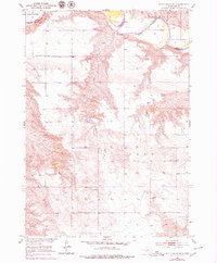
1951 Map of White River NE
USGS Topo · Published 1979About this map
The White River meanders across the northern boundary of this central South Dakota landscape, marking the transition between the rolling uplands and the river valley. In the early 1950s, this area of Mellette and Jones Counties was characterized by a sparse network of section-line roads and widely spaced homesteads. Education was localized in rural schoolhouses like Prosperity Flats Sch in the northwest and Paleck Sch further south, both situated on the high ground overlooking the drainage basins. The map captures the rugged drainage patterns of Kaiser Creek and its unnamed tributaries, which carve deeply into the terrain. Local activity is noted by several Gravel Pit locations, essential for maintaining the rural road system, while the terrain label Zickrick and the district of C O D Y orient the viewer to the specific ranching and farming communities of the period.
Find a feature on this map
9 named features on this map. Tap any name to fly to it.
Don’t see what you’re looking for? This feature index may not catch every label — zoom into the map to look around manually.
Map Details
Editions of this 1951 White River NE Map
3 editions found
Other maps of this area

1951 · Murdo SE
USGS Topo · 1:24,000

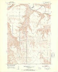
1951 · White River NE
USGS Topo · 1:24,000

1951 · Westover
USGS Topo · 1:24,000

1951 · Badnation NW
USGS Topo · 1:24,000

1951 · Murdo SW
USGS Topo · 1:24,000

1955 · Martin
USGS Topo · 1:250,000

1958 · Martin
USGS Topo · 1:250,000

1970 · Vivian SW
USGS Topo · 1:24,000

1982 · White River SE
USGS Topo · 1:24,000

1982 · Wood North
USGS Topo · 1:24,000