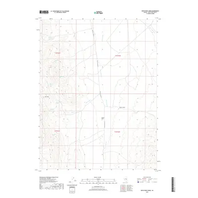
2018 Map of White Rock Creek
USGS Topo · Published 2018About this map
The Egan Range dominates the western half of this map, dropping away into the expansive Steptoe Valley to the east. This transition from high mountain slopes to valley floor is defined by a series of critical water sources, including Little White Rock Spring, Quaky Spring, and White Rock Spring. These perennial points allowed for human activity in a high-desert environment, as evidenced by the drainage names like Cattle Camp Wash and Horse Camp Wash, which suggest a long-standing history of ranching and livestock movement through the area. White Pine Co Road 45 serves as the primary north-south artery through the valley floor. To the south, Basque Canyon provides a named landmark within the foothills, while White Rock Cr drains the central heights, showing the natural hydrologic flow that guided early paths and current boundaries.
Find a feature on this map
19 named features on this map. Tap any name to fly to it.
Don’t see what you’re looking for? This feature index may not catch every label — zoom into the map to look around manually.
Map Details
Editions of this 2018 White Rock Creek Map
This is the sole edition of this map. No revisions or reprints were ever made.
Other maps of this area

1952 · Ely
USGS Topo · 1:125,000

1956 · Lund
USGS Topo · 1:250,000

1956 · Ely
USGS Topo · 1:250,000

1958 · Ely
USGS Topo · 1:62,500

1959 · Ely
USGS Topo · 1:250,000

1959 · Connors Pass
USGS Topo · 1:62,500

1960 · Lund
USGS Topo · 1:250,000

1963 · Ely
USGS Topo · 1:250,000
1973 · White Rock Creek
USGS Topo · 1:24,000

1973 · Cattle Camp Spring
USGS Topo · 1:24,000