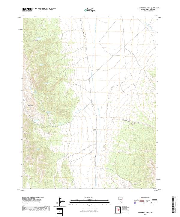
2021 Map of White Rock Creek
USGS Topo · Published 2021About this map
The Egan Range rises sharply above the eastern expanse of Steptoe Valley, creating a landscape defined by its vital water sources and drainage patterns. This high-desert environment is punctuated by numerous named springs that historically sustained livestock and transit through this part of White Pine County. Water features like Little White Rock Spring, East Willow Spring, and Sawmill Spring dot the western slopes, while the White Rock Cr and Cattle Camp Wash carve paths through the alluvial fans. The presence of White Pine Co Road 45 serves as the primary north-south artery through the valley, linking the remote canyons such as Bosque Canyon to the broader regional network. The concentration of springs along the mountain front illustrates the critical relationship between high-elevation snowmelt and the agricultural or ranching potential of the valley floor.
Find a feature on this map
19 named features on this map. Tap any name to fly to it.
Don’t see what you’re looking for? This feature index may not catch every label — zoom into the map to look around manually.
Map Details
Editions of this 2021 White Rock Creek Map
This is the sole edition of this map. No revisions or reprints were ever made.
Other maps of this area

1952 · Ely
USGS Topo · 1:125,000

1956 · Lund
USGS Topo · 1:250,000

1956 · Ely
USGS Topo · 1:250,000

1958 · Ely
USGS Topo · 1:62,500

1959 · Ely
USGS Topo · 1:250,000

1959 · Connors Pass
USGS Topo · 1:62,500

1960 · Lund
USGS Topo · 1:250,000

1963 · Ely
USGS Topo · 1:250,000
1973 · White Rock Creek
USGS Topo · 1:24,000

1973 · Cattle Camp Spring
USGS Topo · 1:24,000