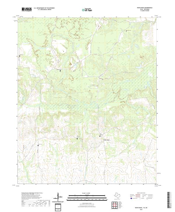
2022 Map of White Rock
USGS Topo · Published 2022About this map
White Rock serves as the central settlement of this Northeast Texas landscape, situated at the intersection of FM 1158 and FM 1699. The terrain is defined by a dense network of intermittent watercourses and marshy lowlands, including the winding Pecan Bayou and Old Goose Pond. For genealogists, the map is remarkably dense with burial sites, preserving the locations of White Rock Cem, Old Concord Cem, and Madras Cem, among several others. These cemeteries are often tucked away near rural routes like Co RD 3205 and Co RD 3217, indicating the scattered settlement patterns of Red River County. The area remains largely rural, with a complex system of farm-to-market roads and county routes connecting isolated homesteads across the drainage basins of Schaffline Cr and White Rock Cr.
Find a feature on this map
44 named features on this map. Tap any name to fly to it.
Don’t see what you’re looking for? This feature index may not catch every label — zoom into the map to look around manually.
Map Details
Editions of this 2022 White Rock Map
This is the sole edition of this map. No revisions or reprints were ever made.
Other maps of this area

1950 · Acworth
USGS Topo · 1:24,000

1950 · White Rock
USGS Topo · 1:24,000

1950 · Annona
USGS Topo · 1:24,000

1951 · Idabel SE
USGS Topo · 1:24,000

1951 · English
USGS Topo · 1:24,000

1951 · Annona
USGS Topo · 1:24,000

1951 · White Rock
USGS Topo · 1:24,000

1951 · Acworth
USGS Topo · 1:24,000

1951 · Avery
USGS Topo · 1:24,000

1951 · Negley
USGS Topo · 1:24,000