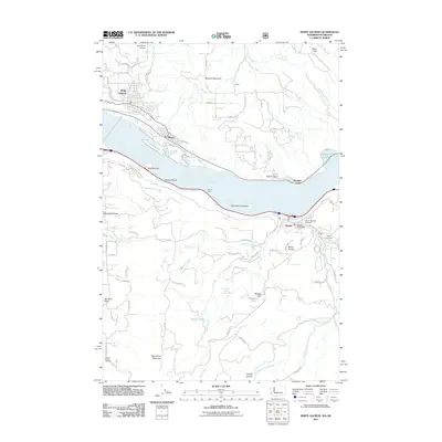
2011 Map of White Salmon
USGS Topo · Published 2011About this map
The Columbia River dominates this 2011 survey, serving as the border between Washington and Oregon and the central corridor for regional transport and settlement. Along the northern bank, the towns of White Salmon and Bingen sit at the base of Burdoin Mountain, while across the water in Oregon, the community of Mosier is clustered near the Mosier Post Office. The landscape is a mix of high-relief terrain like Hood River Mountain and the water-level topography of Koberg Beach and Eighteenmile Island.
Find a feature on this map
84 named features on this map. Tap any name to fly to it.
Don’t see what you’re looking for? This feature index may not catch every label — zoom into the map to look around manually.
Map Details
Editions of this 2011 White Salmon Map
This is the sole edition of this map. No revisions or reprints were ever made.
Other maps of this area

1926 · Hood River
USGS Topo · 1:125,000

1929 · Hood River
USGS Topo · 1:125,000

1934 · The Dalles
USGS Topo · 1:125,000

1953 · The Dalles
USGS Topo · 1:250,000

1956 · The Dalles
USGS Topo · 1:250,000

1957 · The Dalles
USGS Topo · 1:250,000

1957 · Willard
USGS Topo · 1:62,500

1957 · White Salmon
USGS Topo · 1:62,500

1957 · Husum
USGS Topo · 1:62,500

1957 · Hood River
USGS Topo · 1:62,500