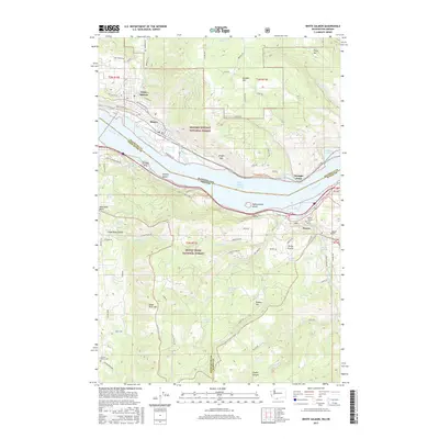
2017 Map of White Salmon
USGS Topo · Published 2017About this map
The Columbia River carves a dramatic path through this 2017 study of the borderlands between Washington and Oregon, framing the established settlements of White Salmon and Bingen to the north and Mosier to the south. The landscape is defined by its steep elevations, ranging from the river banks to the heights of Burdoin Mtn and Tracy Hill. This era shows a complex transportation network where the BNSF Railway and Bingen Range Channel facilitate commerce alongside the winding paths of the Old Columbia River Dr. Local history is anchored by sites such as the Mosier Pioneer Cem and the Jackson Family Cem, while the Mosier Twin Tunnels reflect the engineering efforts required to navigate the Gorge. To the west, the Hood River Valley opens up, while protected lands of the Gifford Pinchot National Forest and Mount Hood National Forest dominate the surrounding high ground.
Find a feature on this map
95 named features on this map. Tap any name to fly to it.
Don’t see what you’re looking for? This feature index may not catch every label — zoom into the map to look around manually.
Map Details
Editions of this 2017 White Salmon Map
This is the sole edition of this map. No revisions or reprints were ever made.
Other maps of this area

1926 · Hood River
USGS Topo · 1:125,000

1929 · Hood River
USGS Topo · 1:125,000

1934 · The Dalles
USGS Topo · 1:125,000

1953 · The Dalles
USGS Topo · 1:250,000

1956 · The Dalles
USGS Topo · 1:250,000

1957 · The Dalles
USGS Topo · 1:250,000

1957 · Willard
USGS Topo · 1:62,500

1957 · White Salmon
USGS Topo · 1:62,500

1957 · Husum
USGS Topo · 1:62,500

1957 · Hood River
USGS Topo · 1:62,500