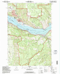
1994 Map of White Salmon
USGS Topo · Published 1996About this map
White Salmon and Bingen sit perched above the Columbia River, marking the northern gateway to the Columbia River Gorge National Scenic Area in the mid-1990s. The landscape reflects a complex boundary zone where the river separates Washington from Oregon and Klickitat from Hood River counties. While the northern shore is dominated by the steep slopes of Burdoin Mountain and the residential core of White Salmon—complete with Skyline Hospital and Columbia High Sch—the southern Oregon side showcases the fruit-growing Hood River Valley and the community of Mosier. Transport infrastructure is central to the area's identity, featuring the Toll Bridge connecting the states and the Burlington Northern railroad lines following the water's edge. From the heights of Panorama Point to the river-level Eighteenmile Island, this map documents a region defined by its topography and the shared waters of the Columbia.
Find a feature on this map
63 named features on this map. Tap any name to fly to it.
Don’t see what you’re looking for? This feature index may not catch every label — zoom into the map to look around manually.
Map Details
Editions of this 1994 White Salmon Map
This is the sole edition of this map. No revisions or reprints were ever made.
Other maps of this area

1926 · Hood River
USGS Topo · 1:125,000

1929 · Hood River
USGS Topo · 1:125,000

1934 · The Dalles
USGS Topo · 1:125,000

1953 · The Dalles
USGS Topo · 1:250,000

1956 · The Dalles
USGS Topo · 1:250,000

1957 · The Dalles
USGS Topo · 1:250,000

1957 · Willard
USGS Topo · 1:62,500

1957 · White Salmon
USGS Topo · 1:62,500

1957 · Husum
USGS Topo · 1:62,500

1957 · Hood River
USGS Topo · 1:62,500