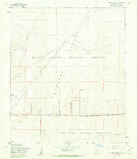
1955 Map of White Sands NE
USGS Topo · Published 1962About this map
The Tularosa Valley landscape of the mid-1950s is defined by vast government installations, with the northern portion of the map dominated by the White Sands Proving Ground and the southern half occupied by the Fort Bliss Military Reservation. This survey, based on 1954 aerial photography, documents the infrastructure of the Cold War era, including a series of towers and an Air Weather Station clustered near the Military Reservation Boundary. While the land is largely dedicated to military use, the presence of Hackberry Well indicates the surviving remnants of earlier ranching or surveying water points that predated the expansion of these sprawling desert test ranges. The map provides a precise layout of the roads and fences used to manage this restricted terrain during a pivotal period of aerospace and ballistic development.
Find a feature on this map
8 named features on this map. Tap any name to fly to it.
Don’t see what you’re looking for? This feature index may not catch every label — zoom into the map to look around manually.
Map Details
Editions of this 1955 White Sands NE Map
2 editions found
Other maps of this area

1916 · Point Of Sands
USGS Topo · 1:125,000

1940 · Orogrande
USGS Topo · 1:62,500

1943 · Parker Lake
USGS Topo · 1:62,500

1943 · Orogrande
USGS Topo · 1:62,500

1947 · Lake Lucero
USGS Topo · 1:62,500

1948 · Davies Tank
USGS Topo · 1:24,000

1948 · El Wood
USGS Topo · 1:24,000
1948 · Parker Lake SE
USGS Topo · 1:24,000

1948 · Elephant Mountain
USGS Topo · 1:24,000
1948 · Parker Lake NE
USGS Topo · 1:24,000