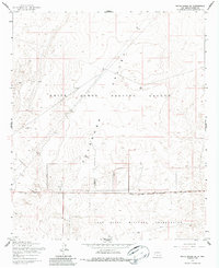
1955 Map of White Sands NE
USGS Topo · Published 1987About this map
White Sands Proving Ground dominates this mid-century landscape in the Tularosa Valley, revealing the Cold War-era expansion of military infrastructure in southern New Mexico. The map details the complex intersection of the Fort Bliss Military Reservation and the proving grounds, delineated by the Military Reservation Boundary.
Find a feature on this map
9 named features on this map. Tap any name to fly to it.
Don’t see what you’re looking for? This feature index may not catch every label — zoom into the map to look around manually.
Map Details
Editions of this 1955 White Sands NE Map
2 editions found
Other maps of this area

1916 · Point Of Sands
USGS Topo · 1:125,000

1940 · Orogrande
USGS Topo · 1:62,500

1943 · Parker Lake
USGS Topo · 1:62,500

1943 · Orogrande
USGS Topo · 1:62,500

1947 · Lake Lucero
USGS Topo · 1:62,500

1948 · Davies Tank
USGS Topo · 1:24,000

1948 · El Wood
USGS Topo · 1:24,000
1948 · Parker Lake SE
USGS Topo · 1:24,000

1948 · Elephant Mountain
USGS Topo · 1:24,000
1948 · Parker Lake NE
USGS Topo · 1:24,000