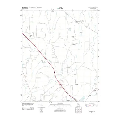
2011 Map of White West
USGS Topo · Published 2011About this map
Pleasant Valley and the surrounding Bartow County landscape are defined by a complex network of creeks and rural crossroads at the start of the 21st century. The terrain is marked by the drainages of Two Run Creek and Pettit Creek, where numerous small family and community burial grounds speak to the area's deep genealogical roots. Settlements such as Dewey Crossroads, Simpson Crossroads, and Five Forks serve as geographic anchors for a region where agriculture and local industry met at water sources like Manning Lake and Aubrey Lake. Historical continuity is evident in landmarks like the Cassville Post Office and the Cassville Cemetery, while multiple churchyards, including Bartow Cumberland Presbyterian Church Cemetery and Woffords Crossroads Baptist Church Cemetery, illustrate the central role of community congregations in this corner of Georgia. The landscape is also dotted with private family plots like the Denman Family Cemetery and Stovall Family Cemetery, which provide essential clues for local historians and family researchers.
Find a feature on this map
107 named features on this map. Tap any name to fly to it.
Don’t see what you’re looking for? This feature index may not catch every label — zoom into the map to look around manually.
Map Details
Editions of this 2011 White West Map
This is the sole edition of this map. No revisions or reprints were ever made.
Other maps of this area

1890 · Cartersville
USGS Topo · 1:125,000

1891 · Cartersville
USGS Topo · 1:125,000

1896 · Cartersville
USGS Topo · 1:125,000

1906 · Stilesboro
USGS Topo · 1:62,500

1907 · Acworth
USGS Topo · 1:62,500

1908 · Stilesboro
USGS Topo · 1:62,500

1909 · Acworth
USGS Topo · 1:62,500

1941 · Adairsville
USGS Topo · 1:62,500

1944 · Adairsville
USGS Topo · 1:62,500

1947 · Waleska
USGS Topo · 1:62,500