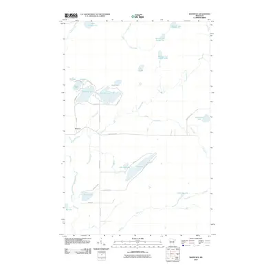
2010 Map of Whiteface
USGS Topo · Published 2010About this map
The Whiteface River winds through this Saint Louis County landscape, defining a region characterized by a dense network of glacial lakes and northern wetlands. Near the small settlement of Whiteface, the river is joined by Picnic Creek and Moonshine Creek, illustrating the complex hydrology of the area. This 2010 survey highlights a distinct cluster of water bodies including West Bass Lake, East Bass Lake, and Round Lake, which are interconnected by a local road network featuring Pearson RD and Pinehurst RD.
Find a feature on this map
39 named features on this map. Tap any name to fly to it.
Don’t see what you’re looking for? This feature index may not catch every label — zoom into the map to look around manually.
Map Details
Editions of this 2010 Whiteface Map
This is the sole edition of this map. No revisions or reprints were ever made.
Other maps of this area

1951 · Central Lakes
USGS Topo · 1:24,000

1951 · Makinen
USGS Topo · 1:24,000

1953 · Canyon
USGS Topo · 1:24,000

1953 · Shaw
USGS Topo · 1:24,000

1953 · Boulder Lake Reservoir
USGS Topo · 1:24,000

1954 · Hibbing
USGS Topo · 1:250,000

1956 · Cotton
USGS Topo · 1:24,000

1956 · Whiteface
USGS Topo · 1:24,000

1957 · Hibbing
USGS Topo · 1:250,000

1957 · Markham
USGS Topo · 1:62,500