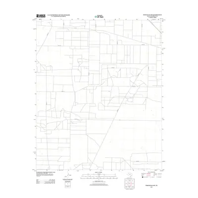
2012 Map of Whiteface SW
USGS Topo · Published 2012About this map
Agricultural grid patterns and secondary transit routes define this section of the High Plains in Cochran County. The landscape is characterized by its organized, rectilinear road network, typical of the rural Llano Estacado. Key transportation corridors such as Fm-769 and Fm-2195 facilitate travel across the wide, level terrain. The dominance of county roads like Co Rd-177, Co Rd-197, and Co Rd-150 indicates a region primarily dedicated to large-scale ranching or farming operations. While traditional settlements are sparse on this specific sheet, the intricate network of local access roads reveals the underlying land-use structure that supports the rural economy of West Texas during the early twenty-first century.
Find a feature on this map
13 named features on this map. Tap any name to fly to it.
Don’t see what you’re looking for? This feature index may not catch every label — zoom into the map to look around manually.
Map Details
Editions of this 2012 Whiteface SW Map
This is the sole edition of this map. No revisions or reprints were ever made.
Other maps of this area

1954 · Brownfield
USGS Topo · 1:250,000

1958 · Brownfield
USGS Topo · 1:250,000

1962 · Brownfield
USGS Topo · 1:250,000

1965 · Plains 1 NE
USGS Topo · 1:24,000

1965 · Pettit
USGS Topo · 1:24,000

1965 · Whiteface
USGS Topo · 1:24,000

1969 · Lehman
USGS Topo · 1:24,000

1970 · Whiteface SW
USGS Topo · 1:24,000

1970 · Plains 1 NW
USGS Topo · 1:24,000

1971 · Whiteface NW
USGS Topo · 1:24,000