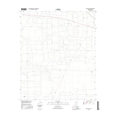
2016 Map of Whiteface SW
USGS Topo · Published 2016About this map
Lost Draw and Sulphur Draw define the subtle topography of this Cochran County landscape, where ephemeral watercourses cut through the high plains of the Texas Panhandle. The area is defined by a rigorous grid of section lines and ranch roads, reflecting the large-scale agricultural and ranching operations characteristic of the region. A primary corridor is formed by FM 169, which arcs across the northern portion of the quadrangle, intersected by a network of county roads including Co RD 150 and Co RD 197. This map documents a sparsely populated but highly organized territory, where the placement of cattle guards, fences, and local thoroughfares like Co RD 190 provides essential context for understanding the land use and property divisions in this corner of West Texas during the early 21st century.
Find a feature on this map
16 named features on this map. Tap any name to fly to it.
Don’t see what you’re looking for? This feature index may not catch every label — zoom into the map to look around manually.
Map Details
Editions of this 2016 Whiteface SW Map
This is the sole edition of this map. No revisions or reprints were ever made.
Other maps of this area

1954 · Brownfield
USGS Topo · 1:250,000

1958 · Brownfield
USGS Topo · 1:250,000

1962 · Brownfield
USGS Topo · 1:250,000

1965 · Plains 1 NE
USGS Topo · 1:24,000

1965 · Pettit
USGS Topo · 1:24,000

1965 · Whiteface
USGS Topo · 1:24,000

1969 · Lehman
USGS Topo · 1:24,000

1970 · Whiteface SW
USGS Topo · 1:24,000

1970 · Plains 1 NW
USGS Topo · 1:24,000

1971 · Whiteface NW
USGS Topo · 1:24,000