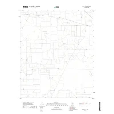
2019 Map of Whiteface SW
USGS Topo · Published 2019About this map
Sulphur Draw and Lost Draw define the subtle topography of this Cochran County landscape, where the seasonal watercourses of the High Plains cut across a strictly surveyed grid of agricultural land. The map reveals a highly structured rural environment dominated by a network of farm-to-market and county roads, including the prominent diagonal of FM 169 and the intersecting paths of Co RD 190 and Co RD 177. This 2019 survey documents the enduring spatial organization of West Texas ranching and farming country, where land use is dictated by the availability of water and the accessibility of transport corridors like Co RD 150 and Co RD 197. The scarcity of named settlements highlights the area's character as a working landscape of expansive private holdings and essential rural infrastructure.
Find a feature on this map
15 named features on this map. Tap any name to fly to it.
Don’t see what you’re looking for? This feature index may not catch every label — zoom into the map to look around manually.
Map Details
Editions of this 2019 Whiteface SW Map
This is the sole edition of this map. No revisions or reprints were ever made.
Other maps of this area

1954 · Brownfield
USGS Topo · 1:250,000

1958 · Brownfield
USGS Topo · 1:250,000

1962 · Brownfield
USGS Topo · 1:250,000

1965 · Plains 1 NE
USGS Topo · 1:24,000

1965 · Pettit
USGS Topo · 1:24,000

1965 · Whiteface
USGS Topo · 1:24,000

1969 · Lehman
USGS Topo · 1:24,000

1970 · Whiteface SW
USGS Topo · 1:24,000

1970 · Plains 1 NW
USGS Topo · 1:24,000

1971 · Whiteface NW
USGS Topo · 1:24,000