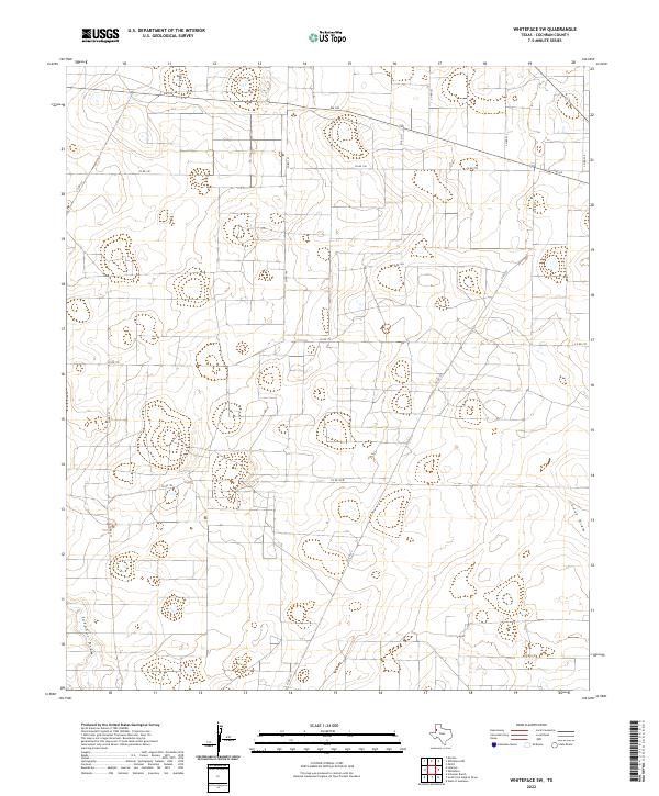
2022 Map of Whiteface SW
USGS Topo · Published 2022About this map
Sulphur Draw and Lost Draw define the topography of this high plains landscape in Cochran County, where ephemeral water channels cut through the level terrain. The map reveals a strictly organized grid of agricultural land and ranch access roads, a testament to the persistent land-use patterns of the Llano Estacado. Primary transit is anchored by FM 169 in the north, while a network of rural routes like Co Rd 190 and Co Rd 150 provides access to interior sections. The absence of concentrated settlements highlights the rural character of this region, emphasizing the importance of named topographic features and county road junctions for local navigation and land identification. This 2022 survey captures the modern state of these rural corridors, showing how the landscape remains dominated by large-scale farming and ranching operations.
Find a feature on this map
15 named features on this map. Tap any name to fly to it.
Don’t see what you’re looking for? This feature index may not catch every label — zoom into the map to look around manually.
Map Details
Editions of this 2022 Whiteface SW Map
This is the sole edition of this map. No revisions or reprints were ever made.
Other maps of this area

1954 · Brownfield
USGS Topo · 1:250,000

1958 · Brownfield
USGS Topo · 1:250,000

1962 · Brownfield
USGS Topo · 1:250,000

1965 · Plains 1 NE
USGS Topo · 1:24,000

1965 · Pettit
USGS Topo · 1:24,000

1965 · Whiteface
USGS Topo · 1:24,000

1969 · Lehman
USGS Topo · 1:24,000

1970 · Whiteface SW
USGS Topo · 1:24,000

1970 · Plains 1 NW
USGS Topo · 1:24,000

1971 · Whiteface NW
USGS Topo · 1:24,000