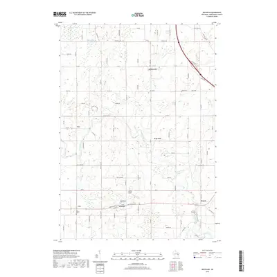
2018 Map of Whitelaw
USGS Topo · Published 2018About this map
Whitelaw and Kellnersville anchor this portion of Manitowoc County, where the landscape is defined by the winding course of the Branch River and the sprawling Cooperstown Swamp. The agricultural character of the region is evident in the network of rural roads such as Polifka Rd and Madson Rd, which connect small crossroads settlements like Reifs Mills and Cato. For those researching family history, the map identifies several local burial grounds, including the Saint Michael's Catholic Cem and Kossuth Cem. The terrain features the unique depression of Thunder Hollow and water bodies like Hempton Lake and Kellners Lake. Aviation interest is represented by the Triple S Ranch Airport, while the Manitowoc River clips the southeastern corner near the community of Branch, illustrating the drainage patterns that shaped early settlement in this part of Wisconsin.
Find a feature on this map
84 named features on this map. Tap any name to fly to it.
Don’t see what you’re looking for? This feature index may not catch every label — zoom into the map to look around manually.
Map Details
Editions of this 2018 Whitelaw Map
This is the sole edition of this map. No revisions or reprints were ever made.
Other maps of this area

1954 · Kewaunee
USGS Topo · 1:62,500

1954 · Manitowoc
USGS Topo · 1:62,500

1954 · Denmark
USGS Topo · 1:62,500

1954 · Reedsville
USGS Topo · 1:62,500

1954 · Manitowoc
USGS Topo · 1:24,000

1954 · Manitowoc
USGS Topo · 1:250,000

1958 · Manitowoc
USGS Topo · 1:250,000
1978 · Clarks Mills
USGS Topo · 1:24,000

1978 · Denmark
USGS Topo · 1:24,000
1978 · Reedsville
USGS Topo · 1:24,000