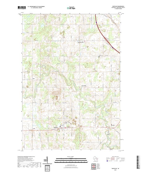
2022 Map of Whitelaw
USGS Topo · Published 2022About this map
Kellnersville and Whitelaw anchor this section of Manitowoc County, where the landscape is defined by the winding course of the Branch River and the rural road networks that link historic dairy-country settlements. The map shows a high density of local heritage sites, including the Kossuth National Cem and Saint Michael's Catholic Cem, serving as critical markers for genealogists and local historians. In the northeast, the Devil's River State Trl follows an old rail alignment, crossing through terrain characterized by significant wetlands like the Cooperstown Swamp. Smaller communities like Taus, Cato, and Branch are mapped in detail, along with family-named landmarks like Thunder Hollow and the Triple S Ranch Airport. This document captures the modern state of these crossroads towns and the surrounding agricultural land before the southern reaches meet the Manitowoc River.
Find a feature on this map
92 named features on this map. Tap any name to fly to it.
Don’t see what you’re looking for? This feature index may not catch every label — zoom into the map to look around manually.
Map Details
Editions of this 2022 Whitelaw Map
This is the sole edition of this map. No revisions or reprints were ever made.
Other maps of this area

1954 · Kewaunee
USGS Topo · 1:62,500

1954 · Manitowoc
USGS Topo · 1:62,500

1954 · Denmark
USGS Topo · 1:62,500

1954 · Reedsville
USGS Topo · 1:62,500

1954 · Manitowoc
USGS Topo · 1:24,000

1954 · Manitowoc
USGS Topo · 1:250,000

1958 · Manitowoc
USGS Topo · 1:250,000
1978 · Clarks Mills
USGS Topo · 1:24,000

1978 · Denmark
USGS Topo · 1:24,000
1978 · Reedsville
USGS Topo · 1:24,000