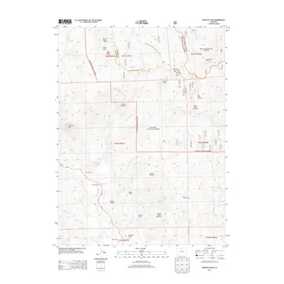
2013 Map of Whiteley Peak
USGS Topo · Published 2013About this map
Rabbit Ears Range and the Continental Divide dominate this high-altitude landscape where the Arapaho National Forest meets the Routt National Forest. This 2013 survey illustrates the rugged watershed of Muddy Cr and its tributaries, including Badger Cr and Lindsey Cr, which carve through deep drainage basins such as Slaughter Gulch and Eastern Gulch.
Find a feature on this map
45 named features on this map. Tap any name to fly to it.
Don’t see what you’re looking for? This feature index may not catch every label — zoom into the map to look around manually.
Map Details
Editions of this 2013 Whiteley Peak Map
This is the sole edition of this map. No revisions or reprints were ever made.
Other maps of this area

1954 · Craig
USGS Topo · 1:250,000

1956 · Rabbit Ears Peak
USGS Topo · 1:24,000

1956 · Lake Agnes
USGS Topo · 1:24,000

1956 · Kremmling
USGS Topo · 1:62,500

1956 · Spicer Peak
USGS Topo · 1:24,000

1956 · Buffalo Peak
USGS Topo · 1:24,000

1956 · Whiteley Peak
USGS Topo · 1:24,000

1956 · Hyannis Peak
USGS Topo · 1:24,000

1956 · Gore Pass
USGS Topo · 1:62,500

1956 · Hyannis Peak
USGS Topo · 1:62,500