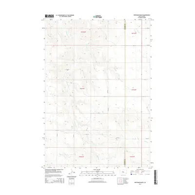
2015 Map of Whiteman Ranch
USGS Topo · Published 2015About this map
Whiteman Ranch stands as the central namesake of this high plains landscape on the border of Haakon and Stanley Counties. The terrain is defined by a dendritic drainage network, with the headwaters of Hermaphrodite Cr and Lone Tree Cr carving subtle coulees through the prairie. In the southeastern corner, the landscape descends toward the valley of Sansarc Cr, joined by its northern tributary, N Fork Sansarc Cr. The mapping reflects a sparse, rural infrastructure typical of the western South Dakota ranchlands, where transportation is dictated by a strict section-line grid of gravel roads and trails. Key arterial routes such as Kirley Rd and Sansarc Rd connect these isolated operations, providing the primary links between the sprawling sections of T7N and T8N.
Find a feature on this map
24 named features on this map. Tap any name to fly to it.
Don’t see what you’re looking for? This feature index may not catch every label — zoom into the map to look around manually.
Map Details
Editions of this 2015 Whiteman Ranch Map
This is the sole edition of this map. No revisions or reprints were ever made.
Other maps of this area

1954 · Pierre
USGS Topo · 1:250,000

1956 · Kirley
USGS Topo · 1:24,000

1956 · Carlin Flat
USGS Topo · 1:24,000

1956 · Alleman Station
USGS Topo · 1:24,000

1956 · Sansarc NE
USGS Topo · 1:24,000

1958 · Pierre
USGS Topo · 1:250,000

1982 · Sansarc
USGS Topo · 1:24,000

1982 · Whiteman Ranch
USGS Topo · 1:24,000

1983 · Bentley Ranch
USGS Topo · 1:24,000

1983 · Hayes North
USGS Topo · 1:24,000