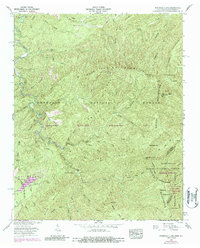
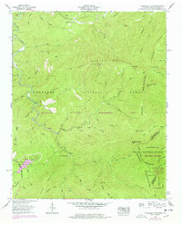
1957 Map of Whiteoak Flats
USGS Topo · Published 1987About this map
Pleasant Grove Ch and a nearby Community Center stand near the northern edge of this high-elevation mountain terrain, marking the sparse human footprint in a landscape dominated by the Cherokee National Forest. This 1957 survey (with 1970s updates) details the complex drainage systems of Citico Creek and its numerous tributaries like Doublecamp Creek and Barkcamp Br. The state line between Tennessee and North Carolina follows the crest of the Unicoi Mountains, separating the Nantahala National Forest from the Cherokee Wildlife Management Area. High peaks and gaps define the region, including Big Fodderstack and the curiously named Jeffrey Hell. The map also captures the Citico Warden Station and the Cold Spring Lookout Tower, essential outposts for managing these extensive protected timberlands and wildlife habitats.
Find a feature on this map
68 named features on this map. Tap any name to fly to it.
Don’t see what you’re looking for? This feature index may not catch every label — zoom into the map to look around manually.
Map Details
Editions of this 1957 Whiteoak Flats Map
5 editions found
Other maps of this area

1886 · Knoxville
USGS Topo · 1:125,000

1892 · Knoxville
USGS Topo · 1:125,000

1893 · Murphy
USGS Topo · 1:125,000

1894 · Knoxville
USGS Topo · 1:125,000

1895 · Loudon
USGS Topo · 1:125,000

1895 · Knoxville
USGS Topo · 1:125,000

1901 · Knoxville
USGS Topo · 1:125,000

1914 · Murphy
USGS Topo · 1:125,000

1927 · Big Junction
USGS Topo · 1:24,000

1933 · Haw Knob
USGS Topo · 1:48,000